Renovating a row home in Philadelphia feels exciting. You picture new space, better light, and higher value. However, many projects hit trouble before the first hammer swings. The issue often has nothing to do with design or budget. Instead, it starts with a property line survey that was skipped, rushed, or misunderstood.
Row homes bring unique challenges. Homes sit close together. Property lines run tight. In older neighborhoods, records do not always match what exists on the ground. Because of that, small assumptions can turn into big problems.
Why Property Lines Are Tricky in Philly Row Homes
Philadelphia row homes were built over many decades. Some date back more than a century. During that time, fences moved, walls shifted, and yards changed hands informally. Even so, legal boundaries stayed the same on paper.
As a result, what looks like your property might not be yours. This matters a lot when you renovate. City permits, neighbors, and inspectors all rely on legal boundaries, not visual cues. That is why a property line survey plays such an important role.
Mistake #1: Trusting Old Fences or Walls
Many homeowners assume fences, brick walls, or garden borders mark the true line. That feels logical. Unfortunately, it often isn’t true.
Over time, fences get replaced. Walls get rebuilt slightly off position. Sometimes, neighbors agree informally to shift a boundary. While that may work for years, it does not change legal ownership.
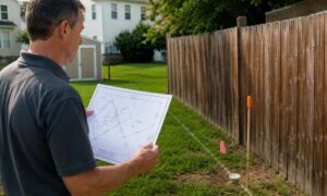
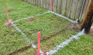
When renovations begin, these hidden issues surface fast. A property line survey shows the legal boundary based on records and field measurements. Without it, you risk building on land that is not yours.
Mistake #2: Thinking Small Renovations Don’t Need a Survey
Another common belief is that surveys only matter for major additions. Many homeowners skip a property line survey for projects like:
- Rear patios
- Decks
- New fences
- Small extensions
However, row homes rarely have extra space to spare. Even a few inches can cross a boundary. Once that happens, problems follow quickly. Neighbors may object. Inspectors may stop work. In some cases, courts get involved.
Starting with a survey avoids those risks. It sets clear limits before construction begins.
Mistake #3: Relying on Online Maps and Property Listings
Online parcel maps feel helpful. They look official. Still, they are not legally accurate.
GIS maps, real estate listings, and satellite images only show approximate lines. They are meant for reference, not construction. They can be off by several feet, which is a huge issue in a row home setting.
A property line survey provides exact measurements tied to legal records. Courts, lenders, and the city rely on that information. Online tools cannot replace it.
Mistake #4: Waiting Until Neighbors Complain
Some homeowners move forward and hope for the best. They assume that if neighbors don’t complain, everything is fine. This approach often backfires.
Neighbors may stay quiet at first. Then, once framing or excavation starts, they notice an issue. At that point, emotions rise. Work slows. Costs increase.
By ordering a property line survey early, you avoid surprises. Clear boundaries help conversations stay calm and factual. That makes a huge difference in tight Philly neighborhoods.
Mistake #5: Getting the Wrong Type of Survey
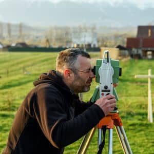
Not all surveys serve the same purpose. This mistake causes confusion and false confidence.
For example, mortgage or loan surveys often focus on general placement, not exact boundary resolution. They may not hold up during disputes or permitting reviews.
A proper property line survey focuses on boundary evidence, measurements, and documentation. It is designed to stand up to scrutiny. Before hiring, homeowners should confirm the survey fits renovation needs, not just closing requirements.
Mistake #6: Waiting Until After Permits Are Submitted
Permits often trigger closer review. If boundary questions appear during that process, delays happen fast. Plans may need revision. Contractors may pause work. Fees can increase.
Ordering a property line survey before submitting plans saves time. It helps architects and contractors design within legal limits from the start. As a result, approvals move faster and projects stay on track.
How a Property Line Survey Protects Your Investment
A renovation costs time, money, and energy. A property line survey protects all three.
First, it confirms where you can legally build. Second, it provides proof if questions arise later. Third, it supports smoother communication with neighbors, inspectors, and contractors.
Most importantly, it reduces stress. Knowing your boundaries allows you to focus on design and quality, not disputes.
When Philly Row Home Owners Should Order One
A property line survey makes sense in many situations, especially when:
- Renovating near side or rear property edges
- Adding structures, fences, or hardscaping
- Working in dense or historic neighborhoods
- Experiencing tension or uncertainty with neighbors
In these cases, clarity early prevents trouble later.
Final Thoughts
Most property line problems do not start with bad intentions. They start with assumptions. Philly row homes magnify those assumptions because space is tight and records are old.
A property line survey is not about finding fault. It is about finding facts. Before renovating, those facts protect your project, your budget, and your peace of mind.
If you plan to renovate a row home, understanding your boundaries is one of the smartest first steps you can take.