
Buying a home in Pittsburgh feels different from buying in a flat city. You’re not just choosing a house. You’re choosing the land under it, and in a place full of hills, that land can bring surprises.
A yard might look clean and level during a showing. The retaining wall might look solid. The slope might not seem like a big deal. Still, what you see on the surface rarely tells the full story.
This is where lidar mapping starts to matter. It gives you a clearer view of the ground before you close, so you can look past what’s visible and start using lidar mapping to spot property risks that don’t show up during a quick walk-through. That way, you’re not guessing. You’re making a decision based on what’s actually there.
Why Pittsburgh Properties Can Be Deceptive
Pittsburgh has layers. Streets cut through hills. Homes sit on carved-out lots. Some yards were shaped decades ago, then modified again over time.
Because of that, many properties don’t follow the natural shape of the land anymore. They’ve been adjusted. Soil has been moved. Walls have been added to hold everything in place.
During a showing, none of that stands out. Fresh landscaping covers uneven ground. Grass hides small dips. A retaining wall might look straight, even if it’s under pressure.
Buyers often rely on what they can see. That works for kitchens and finishes. It doesn’t work for land.
What Lidar Mapping Really Shows
Lidar mapping uses laser data to measure the ground. It shows the shape of the land, even under trees or thick cover.
That matters in Pittsburgh, where small changes can hide in plain sight. What looks flat during a showing may not be flat at all.
Instead of a level yard, you might notice a slight tilt. A gentle slope might turn out to be steeper than it first seemed. Those details tend to stand out when you’re reviewing lidar mapping on a property, just by seeing how different parts of the lot sit next to each other.
At that point, you’re not just going off what you saw during a visit. You’re seeing how the land actually sits.
How Retaining Wall Risks Become Visible

Retaining walls are common across Pittsburgh neighborhoods. They make sloped lots usable. Without them, many homes wouldn’t have a backyard at all.
Still, not all walls are built or maintained the same way.
Some are designed with proper support. Others were added later, sometimes without the right structure behind them. Over time, pressure builds from the soil they hold back.
From the front, everything may look fine. The wall stands straight. The surface looks clean. But the real concern sits behind it.
With lidar mapping, you can see how much elevation that wall is holding. A taller difference often means more force pushing against it. You can also spot uneven ground near the wall, which can signal shifting or added stress.
That kind of detail changes how you look at the property. A wall is no longer just part of the yard. It becomes a key factor in your decision.
Where Grading Problems Start to Show
Grading shapes how the land slopes around a home. It controls where water goes. It also affects how easy it is to build or improve the property later.
In many Pittsburgh homes, grading has changed over time. Soil gets added. Sections get leveled. New features get built.
Those changes don’t always show clearly during a visit.
Lidar mapping brings them into view. You might notice that part of the yard sits higher than the rest. You might see a slope leading toward the house instead of away from it. You might realize that a large portion of the lot isn’t as usable as it seemed.
These are not small details. They affect how the property works day to day. They also shape what you can do with it in the future.
Why These Issues Turn Into Real Costs
Land problems don’t stay on paper. They show up after you move in.
A retaining wall under stress can need repair. That alone can cost more than expected. If grading needs adjustment, you may need extra work before adding anything new to the property.
Even simple plans can change. A patio project might require leveling first. A driveway extension might need support work. Each step adds time and cost.
Buyers often plan based on what they see. Lidar mapping helps you plan based on what’s actually there.
How Buyers Can Use Lidar Mapping Before Closing
You don’t need to be an engineer to start looking at lidar data. Public sources in Pennsylvania offer access to elevation maps and terrain views.
These tools let you explore the shape of the land before making a final decision. You can check how steep a yard really is. You can see how the lot compares to nearby properties. You can spot areas that might need attention.
At the same time, raw data only goes so far. It shows the surface, but it doesn’t explain everything.
Why a Survey Still Matters
Lidar mapping gives you a strong starting point. It shows patterns and changes that you wouldn’t notice during a visit.
Still, it doesn’t replace a professional survey.
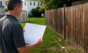
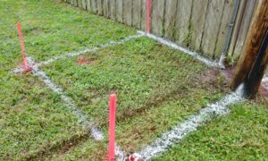
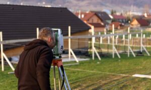
A surveyor can walk the site, confirm elevations, and explain what those changes mean in real terms. They can point out areas that may need work and help you understand how the land will affect your plans.
That extra step gives you confidence. You’re no longer relying on guesses or quick impressions.
Seeing the Property for What It Really Is
Pittsburgh homes often come with character. The hills, the layout, and the views all add to that. Still, those same features can hide challenges that don’t show up right away.
Lidar mapping helps you see past the surface. It shows how the land is shaped and how it might behave over time.
When you take the time to review that before closing, you make a smarter decision. You know what you’re buying. And more importantly, you know what to expect once it’s yours.