land surveying
How a Topographic Survey Helps Identify Backyard Drainage Before Landscaping Begins
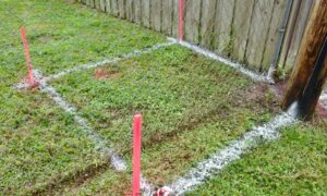
A topographic survey does more than map your land. It shows where water goes when it rains. For developers planning outdoor improvements, that information matters