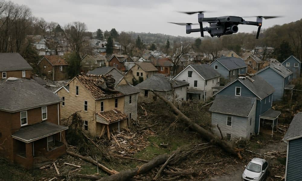
When a strong storm hits, the damage can feel overwhelming. Roofs get torn off, trees fall on houses, and floodwaters leave behind a mess. That’s when a UAV survey becomes incredibly helpful. It gives a fast, clear look at what happened — without anyone needing to climb a ladder or walk through dangerous debris.
UAV stands for Unmanned Aerial Vehicle, but most people just call it a drone. And in the world of property assessment, especially after storms, UAV surveys are changing everything — even right here in Pittsburgh.
How a UAV Survey Helps After a Storm
Let’s face it — no one wants to wait days or weeks to know how bad their property got hit. A UAV survey can be done within hours of the storm passing. Whether it’s a neighborhood in Mt. Washington or a business near the Strip District, drone teams can quickly get in the air and start capturing high-quality images from above.
That aerial view shows damage you can’t always see from the ground. Missing shingles, flooding in the backyard, or fallen power lines — it’s all recorded from a safe distance. And because these drones are equipped with cameras and mapping tools, the data they collect is extremely detailed.
Why Property Owners Rely on UAV Surveys
Between summer storms, flash floods, and heavy snowfall that melts quickly, homes and buildings face serious wear and tear. That’s why more homeowners, insurance agents, and property managers here are turning to UAV surveys after major weather events.
Here’s what makes them so useful:
- Speed: Surveys happen fast. No need to schedule big teams or climb on rooftops.
- Safety: Drones can fly over damaged areas without putting anyone at risk.
- Cost-effectiveness: One drone flight can cover an entire property — even large ones in areas like Shadyside or Oakland.
- Visual proof: Having clear before-and-after images is super helpful for insurance claims.
In a city with as much character (and quirky weather) as Pittsburgh, it just makes sense.
What a UAV Survey Captures After a Storm
You might be surprised by how much a single UAV flight can reveal. It’s more than just flying a drone and snapping pictures. These surveys use smart tools like drone mapping, which has become a go-to method after storms. With it, you can get:
- Clear, high-resolution images of your roof, siding, and yard
- Detailed maps that show the full layout of your property
- 3D models to help spot hidden damage
- Elevation data to check how water flowed or pooled
All of this gives you a full view of the damage — fast, safe, and without anyone needing to climb up or guess what’s going on.

Who Uses UAV Surveys?
The truth is, UAV surveys are for everyone. After a storm, they’re used by:
- Homeowners trying to understand what happened to their property
- Insurance adjusters needing accurate documentation for claims
- Contractors who want a clear picture before starting repairs
- Property managers checking multiple buildings in different neighborhoods
For example, if you manage several rental units in South Side, you can have a drone fly over each one in a single afternoon. That’s way faster than visiting each site in person.
What About Drone Rules?
Yes, there are rules. But don’t worry — licensed drone operators know how to stay compliant. They follow FAA regulations and understand local no-fly zones (like near the airport or certain government buildings).
If you’re hiring a professional UAV survey team, make sure they’re certified. This ensures the job is done safely and the data they collect can be used officially — especially for insurance or legal needs.
Limitations to Keep in Mind
Even though UAV surveys are super useful, they’re not perfect in every situation. For instance:
- Drones can’t fly in heavy rain, high winds, or icy conditions — safety comes first.
- Some properties may have tree cover or obstacles that block views.
- There’s an upfront cost, though it’s often less than traditional inspection methods.
Still, in most cases, especially in urban and suburban parts of Pittsburgh, drones get the job done fast and efficiently.
Looking Ahead:
Technology is only getting better. Soon, UAV surveys could include AI tools that automatically detect roof damage or estimate repair costs. Some teams are already testing real-time video feeds during flights, which could be huge for first responders after severe weather.
As more people see the benefits, it’s likely we’ll see UAVs used for not just storm damage, but also regular maintenance checks, home sales, and even landscaping.
Conclusion:
Storms aren’t just a seasonal thing — they’re part of life here. And when the skies clear, you want answers fast. A UAV survey gives you those answers. It’s safe, quick, and accurate, whether you’re checking out your family home in Lawrenceville or managing commercial property in Downtown.
If you’re dealing with storm damage or just want peace of mind, don’t wait around. Book a UAV survey with a local professional. It’s one of the smartest, most reliable ways to protect your property and make sure nothing gets overlooked.