
How To Find Your Property On FEMA’s Flood Insurance Rate Maps

What are FEMA flood maps?
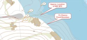
FEMA’s Flood Insurance Rate Maps (FIRMs) or just Flood Maps are provided after a flood risk assessment has been completed or updated for a community.  This study is known as a Flood Insurance Study.  The FIRM gives you the Base Flood Elevations (BFEs) and insurance risk zones in addition to floodplain boundaries.  The FIRM may also show a delineation of the regulatory floodway.

Once the “insurance risk zone”  (commonly referred to as the flood zone) is determined, actuarial rates, based on these risk zones, are then applied for newly constructed, substantially approved, and substantially damaged buildings.  FEMA uses these rates to determine the insurance rate you will pay for flood insurance

FEMA’s Digital Flood Maps

FEMA discontinued the production and distribution of paper flood maps in 2009 as part of its Digital Vision Initiative. This affected all the Flood Maps, boundary information, and study reports. However, clients can still view the products for free through their website or buy them in digital format.

To view these flood maps online, go to FEMA’s Map Service Center and key in your address (hi-lited area shown here) search for your home.  This will prompt you to then select the map that covers your area.  The Flood Maps are somewhat cumbersome to use online. It is best to go through the tutorial on the bottom right of the address search page for an easier and more effective use of the GIS map.

author avatar
Surveyor

More Posts

Land surveyor measuring a residential lot for a subdivision survey in Philadelphia
land surveying
Surveyor

Subdivision Survey Requirements Before Splitting a Property

A subdivision survey is the survey a licensed surveyor runs before one property becomes two or more lots. It shows what you own right now and where the real lines fall. It also shows whether a split can work at all. In Philadelphia, a lot split has to pass city

Read More »
Commercial property in Pennsylvania with an ALTA survey for refinancing
alta survey
Surveyor

Why an ALTA Survey Is Often Requested Before Commercial Refinancing

Commercial lending activity across Pennsylvania has stayed steady even as interest rates shift. Property owners who refinance often assume the process moves faster than a purchase did. A lender will still often want a current ALTA survey before final approval, even though the borrower already holds the deed. Refinancing Creates

Read More »
Aerial view of a shared driveway between neighboring row homes in Philadelphia
land surveying
Surveyor

How Survey Mapping Helps Resolve Shared Driveway Questions

Many older blocks were laid out before shared driveways became a common design choice. Over time, owners built garages, added pavement, or simply started using a strip of land next to a neighbor’s house. Survey mapping gives these situations a clear, measured record. It shows what is physically there, so

Read More »