If you live or work in Pittsburgh, Pennsylvania, you already know the city isn’t flat. Our neighborhoods are full of steep hills, deep valleys, and winding roads. While this gives Pittsburgh its unique charm, it also brings real challenges when it comes to building or developing property. That’s where a topographic survey becomes important.
Whether you’re planning a new home, a driveway, or a large commercial project, a topographic survey in Pittsburgh, Pennsylvania can save you time, money, and stress. Let’s break down what a topographic survey is, why it matters in our city, and when you might need one.

What Is a Topographic Survey?
A topographic survey is a special kind of land survey that maps out the natural and manmade features of a property. This includes things like:
- Hills and slopes
- Trees, rocks, and water features
- Buildings and fences
- Roads and sidewalks
- Elevation changes (how high or low the land is)
The goal is to give property owners, builders, and engineers a clear picture of what the land looks like, both above and below the surface. The survey is usually shown in a detailed map or drawing, often with contour lines to show elevation.
Why Topography Matters in Pittsburgh
Pittsburgh is one of the hilliest cities in the United States. From Mount Washington to the slopes of Squirrel Hill, many properties sit on uneven ground. This makes building more complicated than in flatter areas.
Here are some Pittsburgh-specific challenges that make a topographic survey essential:
1. Hills and Slopes
If your property is on a hill, a topographic survey helps you understand how steep it is. This can affect:
- Foundation design
- Drainage planning
- Where you can build safely
2. Stormwater Runoff
In places like Greenfield or the South Side Slopes, heavy rain can cause water to run downhill fast. Without proper grading, that water can damage your property—or your neighbor’s.
A survey helps your builder design drainage systems that follow local Pittsburgh water management codes.
3. Old and Uneven Lots
Pittsburgh is full of older neighborhoods where land may have shifted over time. Some properties were even built on filled-in ravines or past mine sites. A topographic survey can help identify these issues before construction begins.
When Do You Need a Topographic Survey in Pittsburgh?
You may need a topographic survey in Pittsburgh, Pennsylvania if:
You’re Building a Home or Addition
Before pouring concrete or drawing up blueprints, a survey helps your architect or builder understand what’s possible on your lot.
You’re Installing a Driveway, Fence, or Retaining Wall
Elevation changes can affect slope, runoff, and stability. A survey ensures your plans meet safety and city codes.
You’re Developing or Subdividing Land
If you’re turning a large piece of land into smaller lots, the survey will guide layout, roads, and utility planning.
You’re Solving Drainage or Erosion Problems
A topographic survey can show you where water flows naturally, helping you fix or prevent flooding and erosion.
Local Rules and Building in Pittsburgh
In Pittsburgh and Allegheny County, most construction or land development projects require surveys for permits and approvals. Depending on your location, you may need to follow local zoning laws and grading regulations.
Some hillsides are marked as “steep slope” zones, which come with special rules. A topographic survey is often the first step in getting approval to build in these areas.
What to Expect During a Topographic Survey
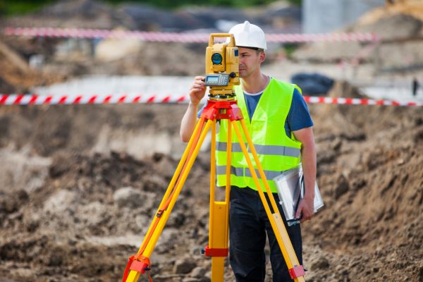
A licensed surveyor will visit your property and use equipment like GPS, drones, or total stations to measure the land. If you’re working with a land surveyor in Pittsburgh, they’ll also be familiar with the city’s steep slopes and local permitting requirements—giving you an edge when planning around elevation and drainage.

Afterward, you’ll receive a detailed map showing:
- Land contours (the shape of the ground)
- Elevation points
- Natural features (trees, streams, etc.)
- Manmade features (walls, buildings, etc.)
Your builder, architect, or engineer will use this map to make safe and accurate plans.
How It Helps You Save Time and Money
While a topographic survey might seem like an extra step, it can actually prevent costly mistakes. For example:
- You won’t build on unstable ground
- You’ll avoid drainage problems later
- You’ll meet local rules the first time
- Your plans will be more accurate
Without a survey, small mistakes can turn into big delays or added costs. Especially in a hilly city like Pittsburgh, guessing the slope or soil condition is risky.
Final Thoughts
Pittsburgh’s beautiful hills make our city stand out, but they also make buildings more complex. A topographic survey in Pittsburgh, Pennsylvania gives you a smart, safe start to any project—whether you’re putting up a new fence or planning a multi-unit development.
If you’re unsure whether your property needs one, it’s worth talking to a licensed land surveyor in your area. They can walk you through the process and help you plan with confidence.
Need guidance on your next project?
Reach out to a local Pittsburgh surveyor to discuss whether a topographic survey is right for your land. It’s one step that can make a big difference.