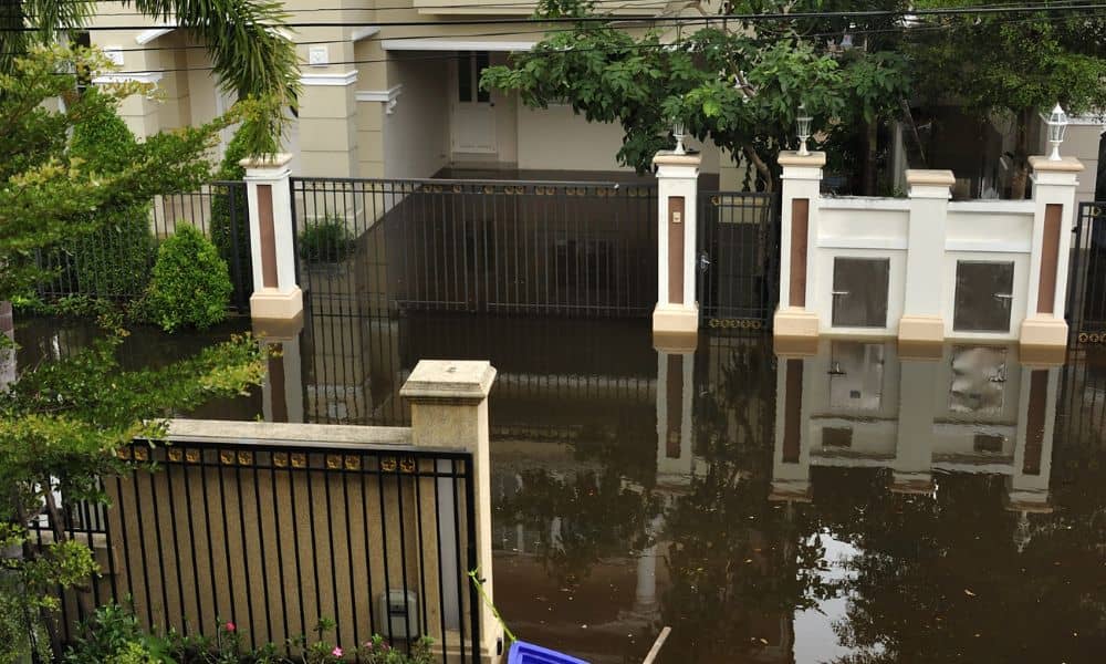
When rain hits Pittsburgh, it doesn’t just soak the streets—it reshapes them. Last week’s storm flooded low-lying neighborhoods, swelled the rivers, and left homeowners wondering if their properties are still as safe as their insurance policies say. If your basement flooded or your yard now pools water where it never did before, it might be time to update your elevation certificate.
Understanding Why the Storm Matters
Pittsburgh’s terrain is no stranger to water. With three rivers and rolling hills, even a few inches of heavy rain can shift soil, erode slopes, or change how water drains around your home. The National Weather Service recently issued flood watches across Allegheny County after record rainfall. When that happens, small elevation changes can have big financial consequences.
Insurance companies and city inspectors depend on accurate elevation data. If your last certificate predates recent floods or renovations, the elevation numbers might no longer reflect reality. In other words, what was once “high and dry” could now sit closer to the flood line than you think.
What an Elevation Certificate Does (and Why It’s Not Just Paperwork)
An elevation certificate shows exactly how high your home or building sits compared to the nearest base flood elevation, or BFE. FEMA sets that BFE as the level floodwaters are expected to reach during a major storm.
Surveyors measure the height of your lowest floor, utilities, and surrounding grade. That information proves your actual risk, helping insurers decide how much you should pay for coverage. The higher your home sits above the flood line, the lower your premiums can be. But if the numbers are old or inaccurate, insurers may assume the worst—and charge you for it.
After the Rain: When to Update Your Certificate
An elevation certificate isn’t a one-and-done document. It’s a snapshot in time. And like any snapshot, it can go out of date. After major rain events, here’s when updating makes sense:
- You’ve noticed erosion or pooling water. Storm runoff might have lowered parts of your yard or changed where water flows.
- You repaired flood damage. If you replace flooring, foundation sections, or utilities, those modifications can affect your elevation data.
- Your property is in a mapped floodplain. Pittsburgh’s Department of Permits, Licenses, and Inspections (PLI) often requires updated certificates before approving repair or rebuilding work in these zones.
- You plan to refinance or renew flood insurance. Lenders and insurers may request updated information, especially after local floods or new FEMA map releases.
How a Surveyor Verifies Changes

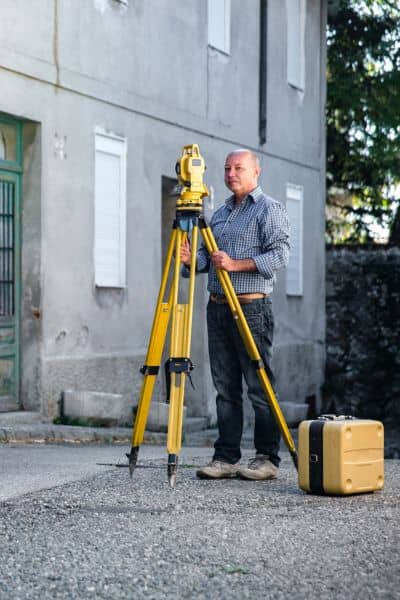
A licensed land surveyor uses GPS and total station tools to measure vertical elevations tied to the official NAVD88 datum—the standard Pittsburgh uses for floodplain compliance.
Here’s what happens during an update:
- The surveyor reviews your existing certificate (if available) and any post-storm repairs.
- They visit your property to take new elevation readings around your foundation, lowest entry, and equipment such as HVAC units or fuel tanks.
- They confirm if any changes in grade or structure affect your flood risk.
- You receive a signed, updated certificate ready for insurers or city reviewers.
It’s a short process—usually just a day of fieldwork and a few days for documentation—but the results can make or break a flood insurance renewal.
Real Pittsburgh Examples
Take the neighborhoods near the Allegheny River. During recent rains, sections of Millvale and Etna saw rising water levels that reached parking lots and driveways. Some homeowners who filed insurance claims were told their existing certificates were too old to verify current flood elevations.
Meanwhile, hillside properties in neighborhoods like Beechview or Mount Washington faced a different challenge: saturated soil that caused minor settling. Even small shifts in retaining walls or driveways can change drainage paths and create new low points. Those owners ordered updated elevation certificates to stay compliant with PLI floodplain standards before starting repairs.
What Happens If You Don’t Update
Ignoring an outdated elevation certificate can have ripple effects. Insurers might flag your file for reinspection or classify your property as higher-risk, which could spike your premiums. If you’re planning construction or renovation in a flood zone, the city might pause or deny permits until you submit an updated document.
Most importantly, you could underestimate your true flood risk. FEMA flood maps change, and Pittsburgh’s mix of rivers, streams, and steep terrain makes even “safe” properties vulnerable after extreme weather.
How to Prepare for an Update
Before calling a surveyor, gather these:
- Your previous elevation certificate (if available).
- Any permits, insurance claim paperwork, or repair photos.
- Notes on where flooding or erosion occurred.
This context helps your surveyor target likely problem areas, saving you both time and cost.
During the visit, stay involved. Ask your surveyor to explain where elevations are taken and how the results affect insurance or permits. The clearer you are about your goals—whether it’s insurance renewal or floodplain compliance—the more tailored your results will be.
The Payoff: Peace of Mind and Proof
An updated elevation certificate isn’t just another document—it’s protection. It ensures your insurance reflects your real risk, not outdated assumptions. It also gives you a clear picture of how your property performed during the storm, which helps you plan drainage improvements or preventive grading.
Think of it as a health check for your home’s flood resilience. You wouldn’t ignore a medical test that could save you thousands later; the same logic applies here.
Simple Signs You Should Act Now
As Pittsburgh dries out, take a quick walk around your property. Look for:
- New or worsening puddles that linger after the rain.
- Tilted fences, cracked retaining walls, or sunken spots near your foundation.
- Mud stains or debris lines showing where water reached.
Any of these could mean your site elevations have changed—and that your certificate no longer matches reality.
Final Thoughts
Every storm tells a new story about Pittsburgh’s landscape. Streets shift, rivers rise, and the ground beneath us moves just enough to matter. The elevation certificate bridges those changes and the numbers that protect your investment.
If the past week’s rains hit your neighborhood hard, don’t wait for another warning to find out you’re unprotected. Schedule an update, get clear data, and make sure your insurance reflects your real situation.
Because when the next storm hits—and in Pittsburgh, it always will—you’ll want more than sandbags. You’ll want proof that your home is built above the line.