
UAV Survey Use for Post-Storm Property Assessments
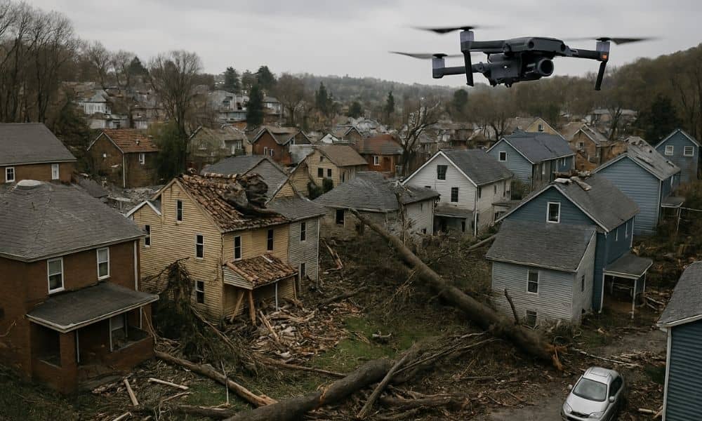
When a strong storm hits, the damage can feel overwhelming. Roofs get torn off, trees fall on houses, and floodwaters leave behind a mess. That’s when a UAV survey becomes incredibly helpful. It gives a fast, clear look at what happened — without anyone needing to climb a ladder or walk through dangerous debris. UAV […]
Flood Elevation Certificate: Key to Insurance Rate

Flooding isn’t just a coastal issue. Heavy rain, overflowing rivers, and poor drainage can put almost any community at risk. If you own a home or plan to buy one, you’ll likely hear about a Flood Elevation Certificate. It’s not just paperwork—it’s a tool that directly affects how much you pay for flood insurance. This […]
Boundary Survey: Why It’s Essential for Philadelphia Homeowners

If you’ve just moved into your new Philadelphia home, getting a boundary survey should be one of your first priorities. Without it, you might soon notice something unusual. For example, your neighbor’s fence could feel too close, or your walkway might seem narrower than expected. What looks like a small quirk could actually be a […]